By Robert Mace, Chief Science Officer at The Meadows Center for Water and the Environment
SUMMARY
-
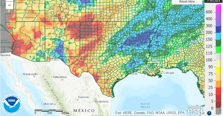
Large areas in West Texas have received less than 10 percent of normal rainfall for the past 90 days.
-
La Niña is expected to fade into neutral conditions (La Nada) by May.
-
Drought conditions in west, far west, south-central, and central Texas are expected to persist and expand over the next three months.
Welcome to the first Outlook+Water for Texas+Water! With this new column, I will focus on rainfall conditions from the previous three-month period and look forward to the next three-month period.
Most of the western half of the state has been bitterly dry, especially from Amarillo through Big Bend and down to Del Rio. Sizable areas around Amarillo have seen less than 10 percent of average rainfall over the past three months (Figure 1). Northeast and southeast Texas and the El Paso area have seen greater-than-normal rainfall over the same period.
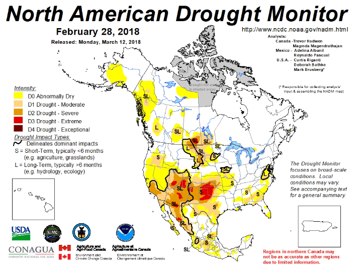
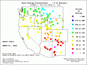
Not unexpected, the North American Drought Monitor reflects these rainfall deficits with extreme drought conditions flaring in the Texas Panhandle (Figure 2). Extreme drought conditions have also afflicted the headwaters of the Rio Grande in southwestern Colorado (Figure 2) for the past three months. Snow in the Rio Grande headwaters (Figure 3) is a significant source of water to Elephant Butte Reservoir (and the El Paso area) farther downstream. Most of the basin that holds the Rios Conchos—a major tributary to the Rio Grande from Mexico that ultimately feeds Lake Amistad and Lake Falcon—has not been in drought over the past three months, although drought is creeping into the area (Figure 2).
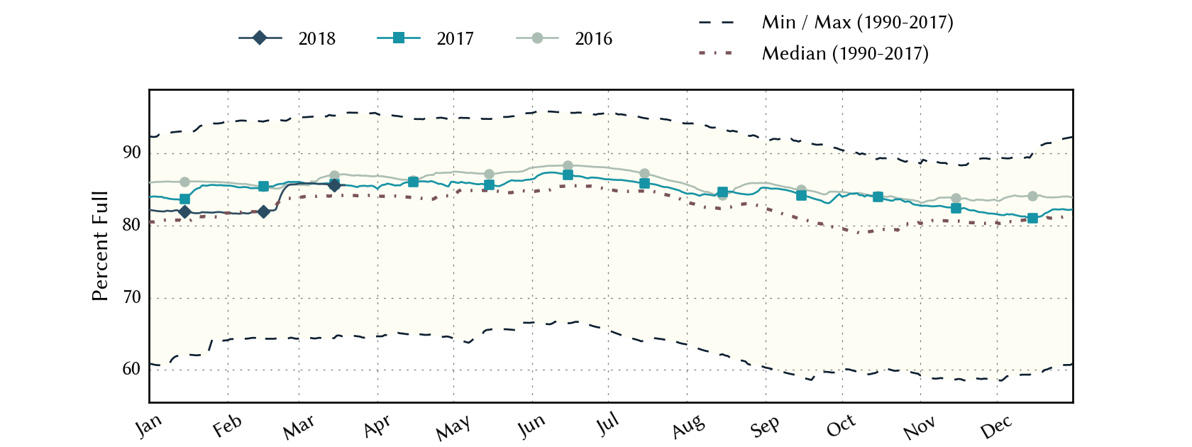
For the state, reservoir storage is above normal (above the median as measured since 1990) at about 86 percent full, which is on par with the previous two years (Figure 4).
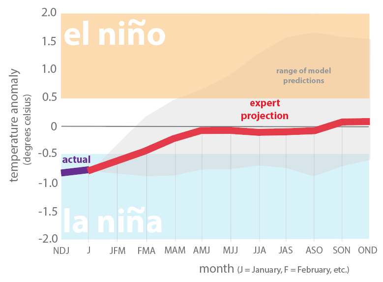
Looking forward, the Climate Prediction Center says that there’s a 55 percent chance for La Niña conditions (which generally result in dryer-than-normal and warmer-than-normal conditions for Texas) to transition to neutral conditions (what the cool kids call “La Nada”) during the March through May period (Figure 5). Furthermore, the Center predicts that La Nada conditions will likely continue through the rest of the year. Since shearing winds from El Niños tend to suppress the formation of tropical systems, that means we may see another active hurricane season.
However, keep in mind that: (1) we are still quite a while away from late summer/early fall, (2) it can be difficult to make accurate predictions this far out, and (3) a number of the models lean Niño (Figure 5).
The U.S. Seasonal Outlook through the end of June is not a pretty picture with drought expected to scourge much of the western two-thirds of the state (Figure 6). El Paso, the Pecos River Valley, and the Lower Rio Grande Valley are expected to join a drought afflicting much of the southwestern United States.
