Associate Program Manager of Water Resources for the NASA Applied Sciences Program

In this issue’s Q&A, Texas+Water Editor-in-Chief, Dr. Todd Votteler, interviews Dr. John D. Bolten, Associate Program Manager of Water Resources for the NASA Applied Sciences Program.
Dr. Bolten is the Associate Program Manager of Water Resources for the NASA Applied Sciences Program. His research focuses on the application of satellite-based remote sensing and land surface hydrological modeling for improved agricultural, ecological, and water resource management. Dr. Bolten is involved in several domestic water resources management efforts, as well as international efforts in the Middle East, Central and North Africa, Southeast Asia. He served on the Panel of Global Hydrological Cycles and Water Resources for the 2017-2027 Decadal Survey for Earth Science and Applications from Space, and is also serving as NASA DEVELOP Program Lead Science Advisor for the NASA Goddard Space Flight Center, as well as Associate Editor for Water Resources Research. He received the M.S. and Ph.D. degrees in geology with an emphasis in hydrology and remote sensing from the University of South Carolina.
What is the mission of the orbiting laboratory Soil Moisture Active Passive (SMAP)?
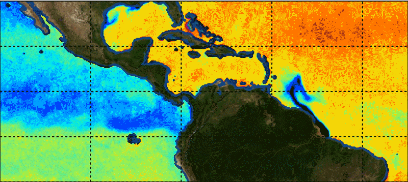
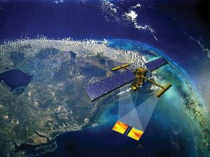
The NASA Soil Moisture Active Passive, or SMAP, mission is a satellite-based observatory that is measuring the amount of water in the top 5 cm of soil. It uses a unique design that strategically applies both radar and radiometer observations in the microwave spectrum over most of the globe. The microwave observations allow us to ‘see’ through short vegetation and estimate the amount of moisture in the soil, as well as identify areas of frozen and unfrozen ground.
What are we learning about the Earth’s water from SMAP?
We are learning a lot! Using observations from SMAP, we are able to have reliable, frequent observations of near-surface soil moisture that can help us characterize, understand, and predict movement of water in the land-atmosphere boundary, which is critical part of the hydrologic cycle. We can assess wetting and drying trends, and better quantify extreme events like droughts, as well as link regional wetting to future events like flooding.
What are some of the ways that the data being collected by SMAP is being used to manage Earth’s water?
SMAP is particularly useful for helping improve our understanding of land surface hydrology dynamics related to regional climate and local weather. The keys to managing water is monitoring water, and accurately assessing water use and water availability. NASA often uses numerical hydrological models to do this. NASA SMAP observations enable us to constrain these models through data assimilation and drive them closer to reality. In this way, we are reducing the uncertainty of streamflow forecasts, agricultural productivity estimates, and identifying areas of freeze-thaw, and flooded areas with improved accuracy and precision.
Does NASA obtain input from water resource managers when developing missions such as SMAP?
Yes! NASA included an applications element in the mission design. In fact, the NASA SMAP mission was one of the first missions to have an Early Adopter Program. The program consists of a test bed of users of SMAP data to apply operational data in their decision making and give feedback. Water managers were included in the group of Early Adopters.
Does NASA have any new water-related missions on the horizon?
Yes, NASA has several exciting missions planned. One is the Surface Water Ocean Topography (SWOT) mission planned for 2022, which will use Lidar and Ku-band radar to measure surface water heights at unprecedented accuracy. Also, NASA is partnering with the Indian Space Research Organization (ISRO) for the NASA ISRO Synthetic Aperture Radar (NISAR), planned for launch in 2022, and will include an L- and S- band radar to provide soil moisture, and map wetlands and agriculture productivity at 100 – 200m resolution.
The opportunity to work with NASA would be a dream job for most scientists. Has Earth science been a lifelong focus for you?
I have loved science since I was very young. When I studied hydrology many years ago, I read that there may someday be a NASA mission dedicated to hydrology and collect estimates of soil moisture by seeing through vegetation. Today I have the great privilege to work with some of the best scientists and engineers on the planet and further refine and apply data from that mission, SMAP, as well as other exciting satellite missions. I certainly feel like I have found my dream job!
Interested in learning more about NASA's work related to water?
See also the Q&A with Michael Watkins, Director of the Jet Propulsion Laboratory, and Lori Magruder, Team Leader for NASA’s Ice, Cloud and Land Elevation Satellite-2 (ICESat-2) Science Definition.