With 38 public universities and 35 private colleges and universities in the state and many more across the country (and the world) interested in Texas, there’s a great deal of academic scholarship focused on water in the Lone Star State. In this column, I provide brief summaries of several recent academic publications on water in Texas.

Let’s start thinking about water!
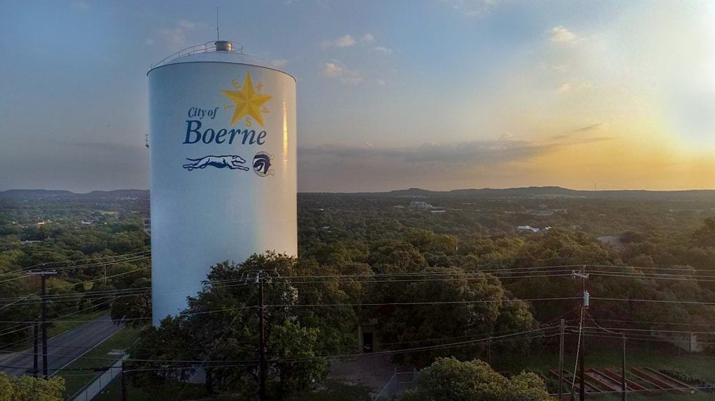
System dynamics modeling in local water management: Assessing strategies for the City of Boerne,Texas

City of Boerne water tower. Photo credit: Christopher Shadrock, City of Boerne
As communities across the Hill Country, Texas, the United States, and the world contend with increasing demand and drought, many options are on the table to extend water supplies. Rueda and crew used causal loop diagrams and system dynamics modeling to help the City of Boerne (the City) assess the impact of stakeholder-chosen strategies of xeriscaping, rainwater harvesting, and smart irrigation systems on water supplies. The authors found that the City can meet needs during drought using the selected strategies in different combinations. Rainwater had the greatest impact on demand but with less effect during drought, with xeriscaping coming in second. Smart irrigation systems did not affect demand since they, like rainwater harvesting, are more useful when it’s raining than during droughts.
Citation
Rueda, V., Young, M.H., Faust, K., Rateb, A., and Leibowicz, B.D., 2022, System dynamics modeling in local water management—Assessing strategies for the City of Boerne, Texas. Water, v14, n 22. doi:10.3390/w14223682
Hydrologic changes in the Brazos River Basin and implications for Great Plains fishes
Early in my career, a Shiner was a delicious brew from the Gulf Coast of Texas. In my current biologically illuminated state, I also know them to be minnow-sized fish that seem to be struggling all over Texas. The Brazos River has its Sharpnose and Smalleye shiners, which have been affected by reservoir construction and groundwater production to the point where their habitats are now relegated to upstream of Possum Kingdom Lake. Wolaver and company looked at climate, reservoir construction, and groundwater pumping to assess how these factors might have affected (and be affecting) shiner habitat. They found that groundwater and surface-water development had reduced flows, increased zero-flow days, and worsened the drought’s effects on the river. Based on this knowledge, the authors suggest that a recovery plan for the shiners needs to include both surface water and groundwater management.
Citation
Wolaver, B.D., Reynolds, L.V., Caldwell, T.G., Bongiovanni, T., Pierre, J.P., Breton, C., and Mayes, K.B., 2024, Hydrologic changes in the Brazos River Basin and implications for Great Plains fishes: Journal of Hydrology. doi:10.1016/j.jhydrol.2023.130351
Technical overview of the TexMesonet—A network of networks for improved water management and prediction in Texas

TexMesonet weather station on Little Blanco River. Photo credit: Gonzales County UWCD
When I worked at the Texas Water Development Board, we had a long (>ten years) dream of having a mesonet similar to one that Oklahoma had us drooling over. For various turf and political reasons, we investigated and unsuccessfully pursued various indirect pathways until I sat down with staff one morning to brainstorm what an agency-run network would look like. There were naysayers—Why are we talking about something we’ve failed to achieve for more than a decade? My response: We’ve tried all the other ways; now let’s try this way. You never know when opportunity will knock. We put together the outline of what we wanted, how much it would cost, how many people we would need, and even selected a name—Texmesonet.
While at lunch, I got a call from the executive office to come upstairs when I got back in the office. At the boss’ desk, I got the news: with the recent flood disaster on the Blanco River in 2015, the Governor’s Office wanted to do something to better warn people about flooding. Did I have any shovel-ready ideas that could be implemented quickly? Thirty minutes later, I pecked out an email to my staff: “We have a mesonet!”
While I can claim a small part of the creation story, the dedicated work of agency staff and the support of the Board and the Legislature have turned the Texmesonet into the data powerhouse it is today. Wyatt and posse present a brief history of the mesonet as well as the nuts and bolts of networking various networks, filling the gaps, and providing a service that meets the needs of water managers, policymakers, and the public using more than 1,700 monitoring sites across the state.
Citation
Wyatt, B.M., Leber, N., and Olden, M., 2023, Technical overview of the TexMesonet—A network of networks for improved water management and prediction in Texas: Journal of Atmospheric & Oceanic Technology, v 40, n 11, p 1449-1459. doi:10.1175/JTECH-D-23-0036.1
Join Our Mailing List
Subscribe to Texas+Water and stay updated on the spectrum of Texas water issues including science, policy, and law.